Draw Your Own Vinegar Flats Map
You don’t need planning software to tell the City what you think. Print a map, grab some colored pencils, and draw where you think growth belongs and what you think should be protected. Then send your drawing to the City as your public comment.
1Print the maps
There are four maps below. Print any of them, or all four. Each one prints best on its own page in landscape. Click a map to open it full size, then print from your browser.
No printer? Pick up printed copies at one of our working sessions this week, or call (509) 724-0331 and we’ll help.
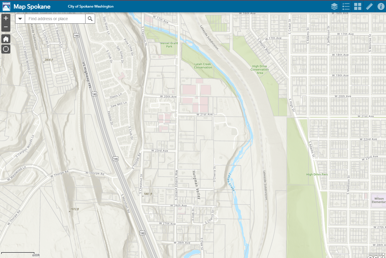
Streets, Latah Creek, Inland Empire Way and US 195 with no land-use colors. This is your blank canvas.
Open full size ↗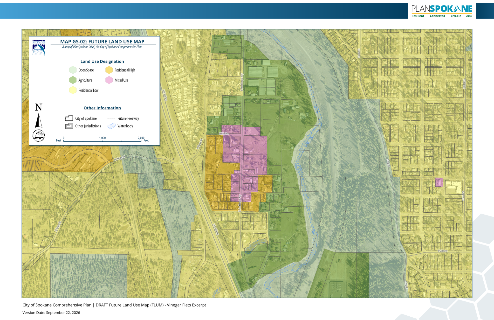
The PlanSpokane 2046 draft now open for comment. Compare it with your own ideas.
Open full size ↗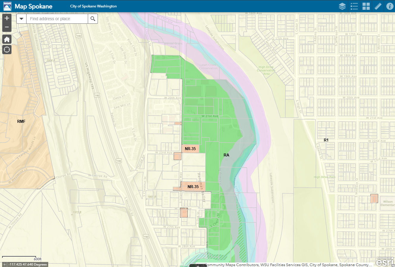
The land-use designations in place today, including the agricultural land along Latah Creek.
Open full size ↗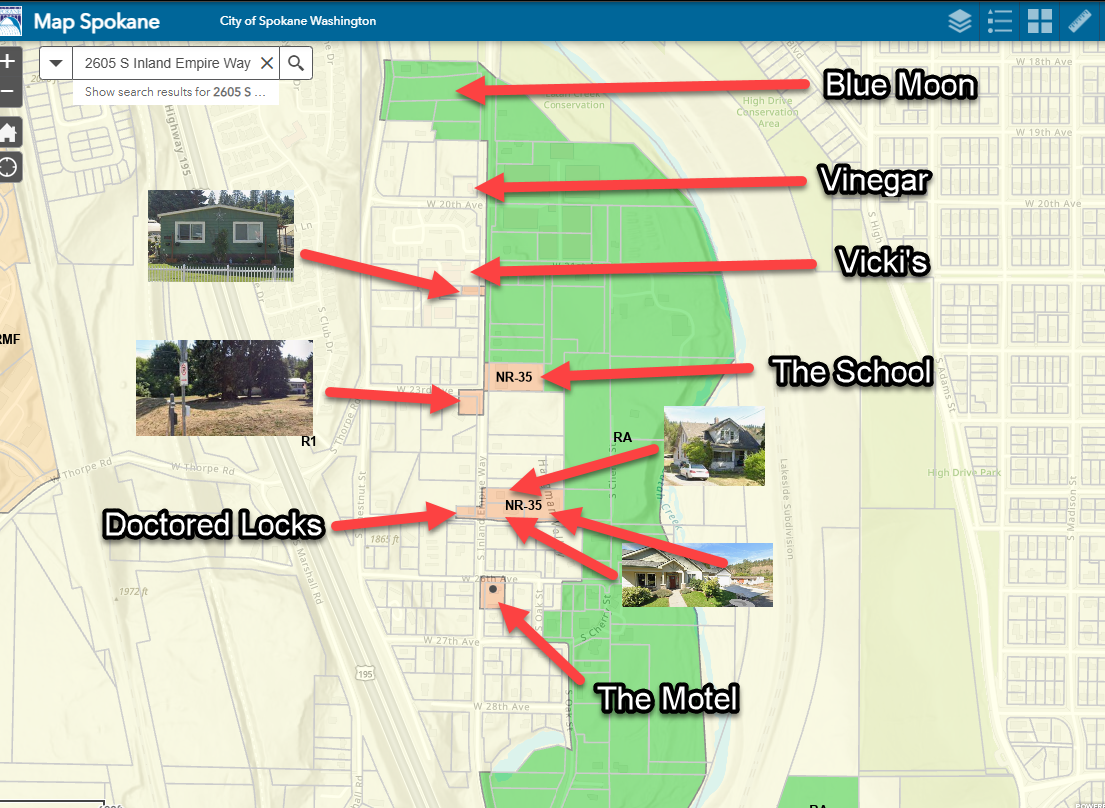
Blue Moon, Vinegar, Vicki’s, the school, Doctored Locks and the motel are labeled to help you get your bearings.
Open full size ↗2Draw your ideas
Color in where you think each kind of land use should go. Use any colors you like, as long as you add a key so the City knows what each color means. Here’s a simple one you can copy:
| Color | Designation | What it allows | Homes per acre |
|---|---|---|---|
| Green | Agriculture | Farming, greenhouses, agritourism | Low intensity |
| Yellow | Residential Low | Houses and middle housing | 6–10 |
| Orange | Residential High | Apartments, townhomes, neighborhood retail | 15–40 |
| Pink | Mixed Use | Shops and services with housing | 10–45 |
| Blue | Protect | Creek buffers, wildlife corridors, open space, views | — |
Homes-per-acre ranges are from the City’s draft designations. Exact heights, setbacks and buffers are set later, in zoning, so write those ideas in the margins.
Tips for a strong map comment
- Write your name and address on the page. Comments tied to a location carry the most weight.
- Add short notes in the margins that say why. For example: “keep this farmland,” “creek buffer here,” or “shops along Inland Empire Way.”
- Mark distances if they matter to you, like a 200-foot corridor or a buffer from the creek.
- One clear idea is enough. You don’t have to redraw the whole valley.
3Send it to the City
Take a clear photo or scan of your map and send it before 5 p.m. Friday, October 2.
Send to PlanSpokane@spokanecity.org with the subject “Vinegar Flats – Draft FLUM comment.” Attach your photo or scan.
Drop off at the Development Services Center, 3rd floor of City Hall, 808 W Spokane Falls Blvd.
Bring it to City Council’s open forum on Wednesday, September 30, at 6 p.m.
Please copy us too. CC latahvalleync@gmail.com or send us a photo. We’d love to see your ideas and count how many Vinegar Flats neighbors took part.